Designed to put your data in motion.
GeoStamp leverages location data and predictive analytics on its geospatial platform to deliver throughput, optimization, and intelligence for the supply chain and logistics industry.


Delay Time and Performance Monitoring
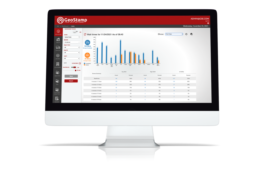
GeoStamp Track monitors assets moving to and from given locations using custom-built geofencing technology. Through an API integration, Track leans into existing hardware to provide new and valuable insights for trucking and logistics companies. Track has been utilized by trucking companies, port authorities, and logistics facilities to monitor and improve congestion trends for more throughput and optimization. Delay time is a key component of a trucking company’s customer service and Track makes it easy to report on delay time to BCO’s and other customers.Maximize Capacity
Prevent wasted time by ensuring your dispatched drivers are being sent to the most efficient terminals and on the most effective dispatches.
Streamline Payments
Save customer service reps time and energy by leaning into Track’s prepared reports that are ready made for paying drivers for delay time.
Simplify Reports
Review prepared reports on average driver delay time to ensure the operations team is as effective as possible in both dispatch and execution.

Dispatch Planning and Optimization
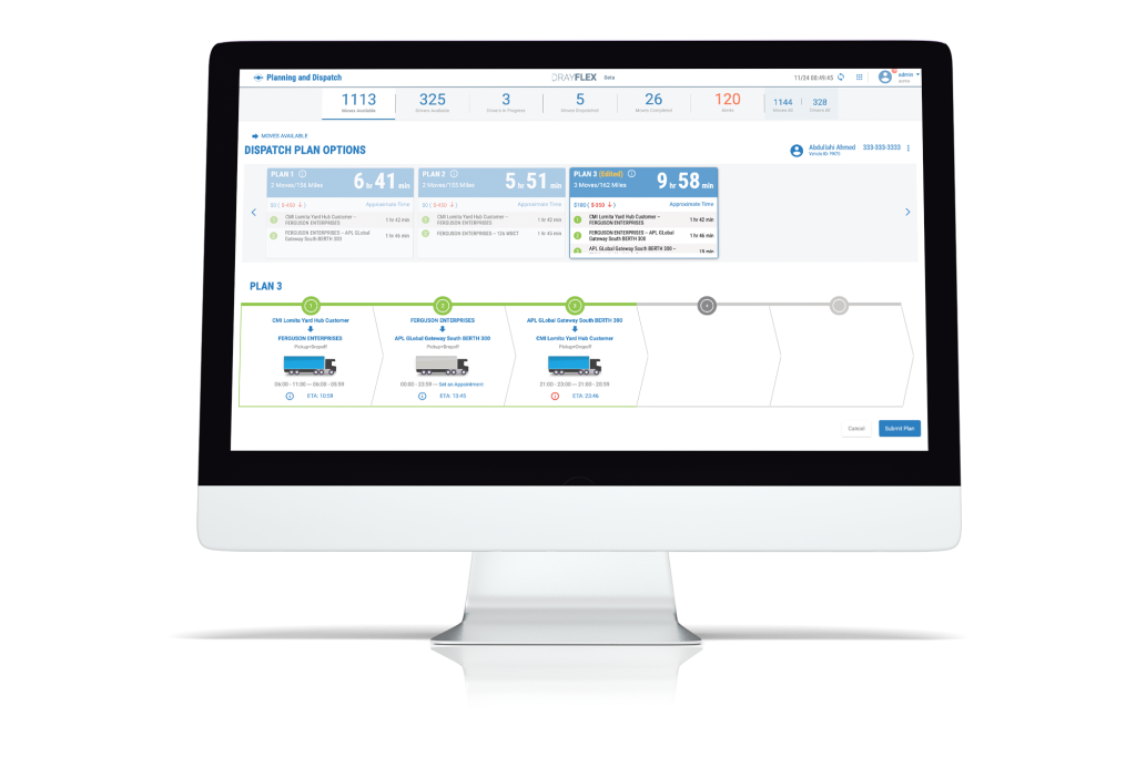
GeoStamp Optimize has a unique ability to combine data from dozens of data sources. Including Truck Management Systems, Terminal Operating Systems, GPS providers, traffic applications, GeoStamp’s Track application, and many others to provide optimized and performant dispatch plans. In addition, support legs are simplified through time and distance associations with bobtails and empty chassis legs automatically factored into dispatch plans; reducing missed appointments and unexpected delays.
Maximize Driver Utilization
Predictive analytics used to optimize best-match, multi-leg driver routes based on time, distance, terminal wait time, and many other factors.
Streamline Dispatch Planning
Dispatchers spend less time exploring endless options, and instantly leverage best-match and route-optimized dispatch plans.
Reduce Fees
A purpose-built scoring engine prioritizes plans based on last-free-day and predictive analytics minimizes the risk of missing loads due to traffic conditions or terminal delays – the result: greatly reduced or eliminated detention and demurrage charges alongside optimized dispatch plans.
Better Data, Better Dispatch Plans
Best-match plans are created in real-time based on the latest TMS order data. Geospatial data leverages established route distance and time-of-day travel durations.
